Explore the island with the Young's Bicycle Shop Nantucket map
Young's Bicycle Shop has created some of the best maps for visiting the island since the 1950s. Check out our latest version of the Young's Nantucket map and start planning your trip. And be sure to sure to stop by the shop and pick up a free physical copy as a souvenir! These great maps come included with every bike, car, and Jeep rental.
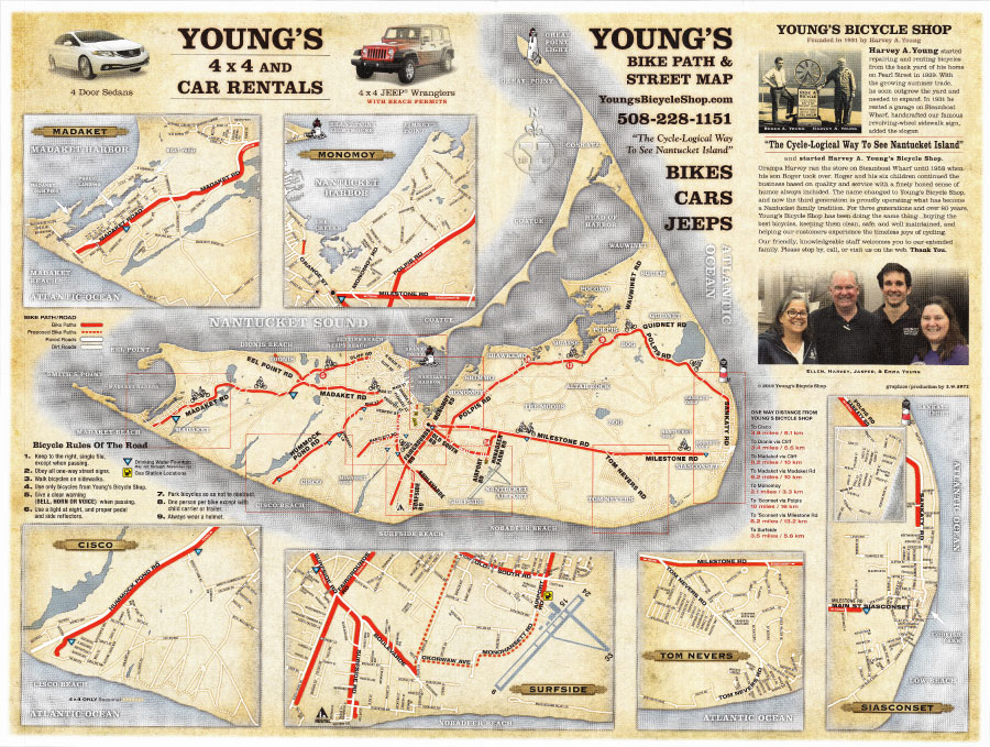
On the front of the Young's map of Nantucket there is a full island view accompanied by individual magnifications of the different areas of The Grey Lady. We've included the rules of the road for cyclists, the distances of our bike paths, as well as a short history of Young's Bicycle Shop.
Other Maps of Nantucket Island
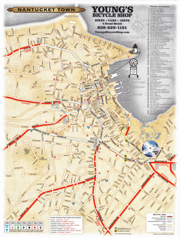
Map of Nantucket Town
On the back of the Young's Nantucket Map there is a full blowup of Town, which you can use to explore the island's famous historic district. Town is full of houses from the 1800s as well as beautiful wharfs and plenty of restaurants and shops.
This map is packed with useful info:
- over 60 points of interest
- locations of all the paved, separated bicycle paths that start from Town and their lengths
- the Young's Self Guided-Tour route (outlined in purple)
- locations of water fountains and gas stations
- locations of popular beaches
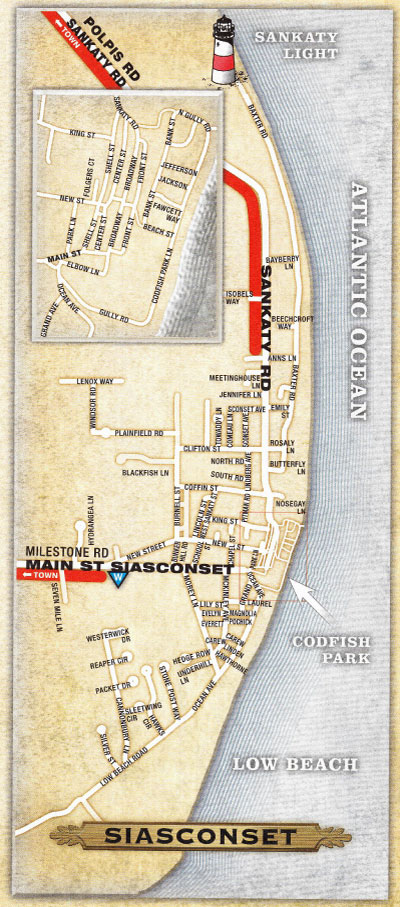
Map of Siasconset ('Sconset)
Siasconset, or just 'Sconset to the locals, is at the eastern end of Nantucket. You'll find quaint little cottages as well as cliffside mansions, a public beach, and the famous Sankatay Head Lighthouse.
'Sconset is one of the most popular destinations for visitors, as the sleepy little village with expansive ocean views is perfect for a sight seeing bike ride.
There are two paved bike paths that lead to 'Sconset from Town, the Polpis Rd and Milestone Rd paths.
You'll also be able to find a bite to eat at Claudette's Sandwiches or the 'Sconset Market (both open seasonally) to fuel your ride back.
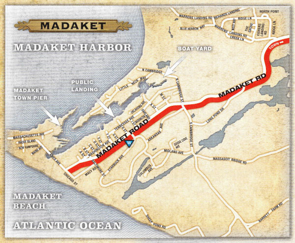
Map of Madaket
Madaket lies at the westernmost end of Nantucket and is another extremely popular spot for visitors and locals alike.
It's a great spot to catch the sunset over the water, although it's not our favorite place to swim.
In season you'll be able to grab lunch or dinner at Millie's Restaurant and pick up an ice cream at Millie's market.
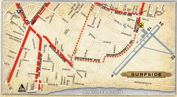
Map of Surfside
Surfside is probably the most popular beach destination on Nantucket. There's plenty of beach to explore, as well as a typically safer current than the beaches at the ends of the island.
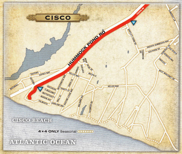
Map of Cisco
East of Madaket is Cisco, is another popular places for beachgoers. Some of the best surfing on the island is by Cisco beach, so you'll find plenty of visitors and locals alike there.
On your way to or from the beach, there are plenty of options for food and drinks at Bartlett's Farm, Cisco Brewers, and 167 Raw.
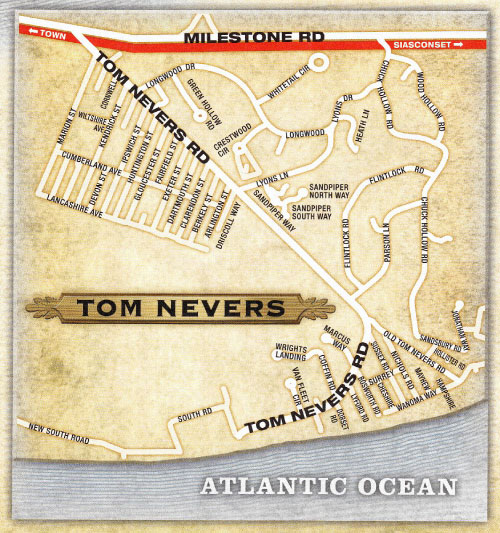
Map of Tom Nevers
Tom Nevers is located just west of 'Sconset, and largely comprised of residential homes.
There is a public beach there, but we recommend areas like Surfside and Cisco over Tom Nevers when it comes to enjoying the beach. The beach at Tom Nevers is not as wide or clear, and there are no amenities.
That being said, there are usually much fewer people if crowds are your primary concern.
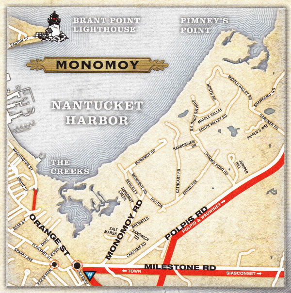
Map of Monomoy
Most visitors never make it to Monomoy, a small area east of town near the Nantucket harbor.
There's no dedicated bike path on Monomy road, and the public beaches there are mostly used by locals launching their small watercraft.
Just about everywhere is pretty on Nantucket an Monomoy is no exception, but you won't miss much by choosing to explore other areas.
History of the Young's Map of Nantucket
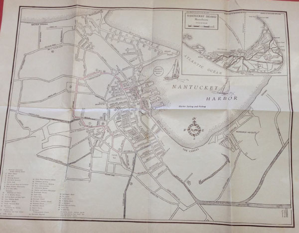
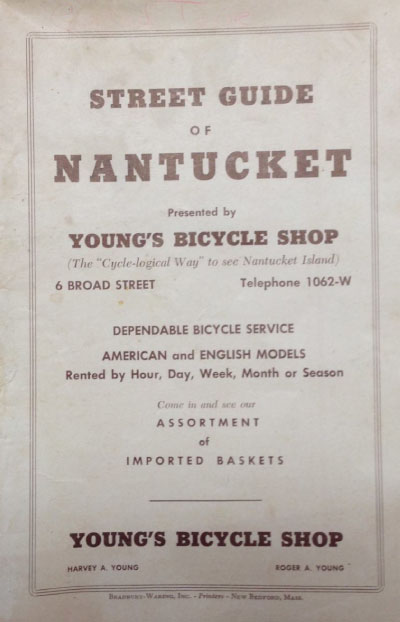
For over 70 years, Young's Bicycle Shop has offered a paper map to visitors so they can explore the island. Check out some of our earliest maps of Nantucket below.
Ready to explore Nantucket?
Young's has been helping visitors experience the island since 1931, and we hope you'll pay us a visit and rent bikes or rent a vehicle with us during your stay. We'd love to show you the Cycle-Logical Way To See Nantucket!
